
English| EUR
Suggested for you
More currencies
Choose a language
The Royal Canal runs parallel to Dublin's River Liffey along the city's northside, stretching from Spencer Dock in the city center westward through Phibsborough, Cabra, and Castleknock before continuing toward the Shannon. This guide maps the canal's route through Dublin, identifies major access points along its towpath, and explains how the waterway connects neighborhoods across the northside.
Quick answer
The Royal Canal runs along Dublin's northside, beginning at Spencer Dock near the 3Arena and extending westward through Drumcondra, Phibsborough, Cabra, Ashtown, and Castleknock before leaving the city limits. The canal flows parallel to the River Liffey approximately two kilometers north of it, crossing through residential and industrial districts before entering rural County Kildare and eventually joining the River Shannon.
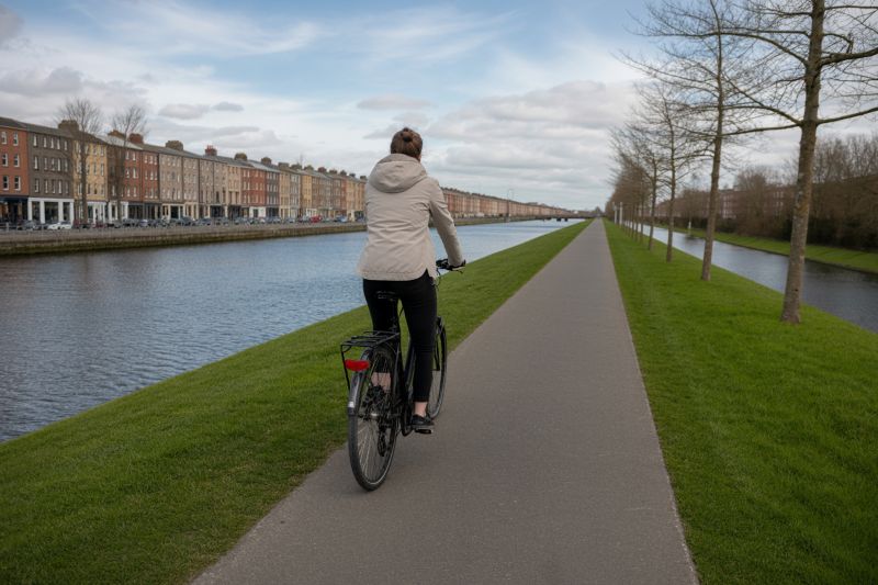
The Royal Canal was completed in 1817 as a transport artery linking Dublin to the River Shannon, and its 146-kilometer route begins at Spencer Dock on the northside quays. From its basin near the 3Arena, the waterway heads northwest through Drumcondra, passing beneath the railway bridge at Connolly Station and continuing through Phibsborough where Cross Guns Bridge marks one of the most recognizable crossings. The canal then curves westward through Cabra and Ashtown, its towpath forming a continuous greenway that walkers and cyclists use to traverse the city without encountering major road junctions. Understanding where the Royal Canal sits relative to Dublin's River Liffey helps orient visitors unfamiliar with the city's dual-canal layout. While the Grand Canal defines the southside boundary, the Royal Canal runs roughly parallel to the Liffey's northern bank, separated by two kilometers of residential streets and commercial zones. The canal passes through neighborhoods that developed around its locks and harbors during the nineteenth century, and many of these districts—Phibsborough, Glasnevin, Castleknock—retain the street patterns and stone bridges that date to the canal's construction era. The towpath remains publicly accessible along most of its Dublin section, managed by Waterways Ireland, and the greenway designation ensures walkers can follow the route from the city center to the county border without interruption. The route of the Royal Canal through Dublin is marked by fifteen locks that lift the waterway from sea level at Spencer Dock to higher ground west of the city. Lock markers and bridge numbers appear at regular intervals, and these serve as reference points for anyone navigating the towpath on foot or by bicycle. The canal passes several parks—Broom Bridge, Ashtown, Castleknock—where the greenway widens into recreational zones with benches and information panels describing the canal's engineering history. The towpath surface is compacted stone and gravel for most of its length, suitable for walking year-round and for road bicycles in dry conditions. Access points to the canal are distributed across the northside, with the most central entry at Spencer Dock where the towpath begins beside the Convention Centre Dublin. Further west, Cross Guns Bridge in Phibsborough and Broombridge in Cabra provide street-level access with nearby public transport connections, and the Ashtown section offers parking adjacent to the towpath near the M50 crossing. The canal's alignment through Dublin follows the 30-meter contour line, avoiding steep gradients and keeping the waterway navigable for the barges that once carried goods between the capital and the interior. That contour-hugging route gives the canal its characteristic curve through the city's northern suburbs, and the same engineering logic that determined its path two centuries ago now shapes the greenway experience for modern users. The Royal Canal's location on the northside positions it as a quieter counterpart to the Grand Canal, attracting fewer tourists but offering a longer uninterrupted towpath for distance walkers and cyclists. The waterway remains navigable for leisure craft, and narrowboats moor at several points along the Dublin section during the summer months. The towpath is open 24 hours, and the best light for photography and sightseeing falls between 08:00 and 20:00 when the canal's tree canopy and stone bridges are evenly lit. Waterways Ireland maintains the canal infrastructure and publishes route maps that detail lock positions, bridge crossings, and access points across the entire Dublin section.
“The Royal Canal's 146-kilometer route begins at Spencer Dock and curves westward through Dublin's northside, its towpath forming a continuous greenway from the city center to the Shannon.”
The Royal Canal enters Dublin from the west, traversing through areas such as Phibsborough and Drumcondra before meeting the River Liffey at Spencer Dock. The most accessible entry points for visitors are located near the city center, particularly around the Dublin Connolly and Docklands rail stations.
Commuter line to Dublin Connolly Station
Dublin Bus routes 11, 13, or 40 to Phibsborough
Walk from O'Connell Street via Dorset Street
Request drop-off at Newcomen Bridge
Alighting at Dublin Connolly Station places you within a short walk of the canal's eastern terminus at the River Liffey. For those seeking a quieter walking experience, head north to the Phibsborough section, which offers immediate access to the canal towpaths.
The Royal Canal towpaths are accessible to the public 24 hours a day, seven days a week.
The best arrival window is 08:00–20:00 to utilize natural light for walking or cycling the towpaths. Visiting during these hours provides the clearest visibility for the canal scenery.
Mild with temperatures of 10°C–15°C
Longer daylight hours support extended outdoor activity along the canal banks.
Warm with temperatures of 15°C–20°C
The canal is busiest during these months, offering a vibrant atmosphere for towpath users.
Cooler with temperatures of 9°C–14°C
Early autumn provides stable weather conditions suitable for scenic canal walks.
—
Early visits offer quiet conditions for those looking to experience the canal before the midday peak.
Verdict: For the most balanced experience, visit Monday to Thursday between 09:00 and 11:00 during the months of May or September.
Everything you need to know about where is the royal canal in dublin
The Royal Canal is located to the north of Dublin city centre, running parallel to the Grand Canal which sits on the south side. While both are significant Dublin landmarks, the Royal Canal flows through areas such as Phibsborough and Ashtown, distinct from the Grand Canal corridor. Knowing where is the royal canal in dublin helps visitors distinguish between the two primary historic waterways traversing the capital.
There is 0 EUR entrance fee for public access to the canal towpaths and greenway. Visitors are free to explore these historic routes at their leisure without purchasing a ticket. This makes walking or cycling along the path a budget-friendly way to see the city.
The best arrival window is 08:00–20:00 to enjoy the best natural light for walking or cycling the towpaths and taking in the scenery. This timing ensures clear visibility for those exploring the canal banks. Planning your visit within this window is recommended for the most enjoyable experience.
Cycling is a popular way to traverse the Royal Canal greenway and towpaths, offering a unique perspective of the city infrastructure. It is a favored activity for locals and visitors looking to explore Dublin landmarks by bike. Understanding where is the royal canal in dublin allows cyclists to plan their route through these accessible public spaces.
While there are no specific guided tours listed here, many visitors enjoy self-guided walks or seasonal cruises on the city waterways. If you are interested in a more structured experience, consider booking a dinner cruise to see the canals from the water. Explore our booking options to discover available excursions on the canal network.
The Royal Canal is accessible from various points in Dublin, with many paths starting near public transport links. You can check local maps for the nearest station to your chosen segment of the towpath. If you are still asking where is the royal canal in dublin after checking your map, look for the greenway signage near main arterial routes.